
FROM NORHT TO SOUTH: ARGENTINIAN PATAGONIA
Puerto Madryn
Book
Quote
Duration
15 D / 14 N
Type
Program
Beginning of the experience
Reception and transfer from Puerto Madryn Airport to the hotel.
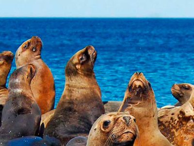
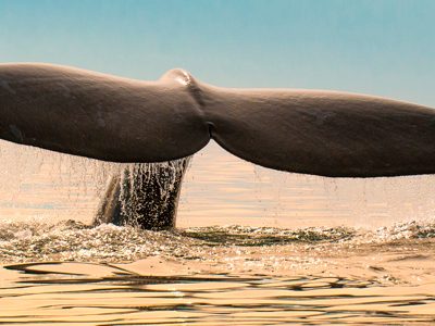
Breakfast at the hotel. We begin our day by visiting one of the most beautiful Atlantic cities in Argentina: Puerto Madryn. The main attraction in the region is the sighting of the Southern Right Whale. We continue our excursion by heading about 17 km south of the city, where we arrive at the Punta Loma Protected Natural Reserve. This vantage point stands out for being the chosen place for the one-haired sea lions for their habitat, not to mention the entire communities of birds, reptiles, and mammals, such as cormorants, seagulls, etc.
Optional: Nighttime Patagonia to Cerro Avanzado
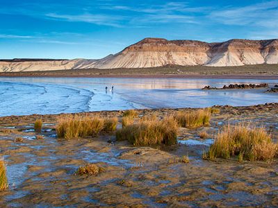
Before nightfall, we set out for a special journey: Cerro Avanzado, just about 20 kilometers south of Puerto Madryn, where we take a unique night tour with a full moon.
We embark on a mini-trek, where we can learn about the local vegetation, geological formations, and discover the remains of marine fossils resting in that area. We descend through the sandbank to the end of the great canyon, walking along the beach, and then head to enjoy a good appetizer and a glass of wine surrounded by nature. The Patagonian sky delights us with all its beauty, and we can enjoy the sound and moonlit figures of the Southern Right Whale.
Breakfast at the contracted accommodation. We explore the Peninsula Valdés Natural Protected Area, located 50 km from the city of Puerto Madryn, declared by UNESCO as a Natural Heritage of Humanity, considering it one of the most interesting ecosystems on Earth. We may encounter the Southern Right Whale, as well as orcas, sea lions, and elephant seals, Magellanic penguins, rheas, etc. Our first stop is at the Interpretation Center, observing the Isla de los Pájaros, a reserve created in 1967 with the aim of protecting the large groups of birds that inhabit the area. Continuing our journey, we head to Puerto Pirámides, which is about 28 km from the city.
Between the months of July and November, you can embark on rubber boats to go whale watching. In June and December, the probability is significantly reduced. If it is the whale-watching season, we embark for a little over an hour, protected with life jackets. From Puerto Pirámides, we go to the Elephant Seals nesting site at Caleta Valdés, passing through Gran Salitral with an area of 35 km2. Finally, we go to Punta Norte, at the northeastern tip of the peninsula, if it is summer, and to Punta Delgada if it is the rest of the year, with the aim of seeing colonies of sea lions and elephant seals. In Punta Norte, if luck is on our side, we may even see orcas.
Note about Whale Watching: It takes place between the months of July and November. It is advisable to wear waterproof and windproof clothing. Before the start of the trip, basic pre-trip advice is offered. The adventure is available for both adults and children.
Breakfast at the hotel. Today we visit the most important Magellanic penguin colony in South America: Punta Tombo, located south of the Lower Chubut River Valley. In its beginnings 50 years ago, it was a natural reserve, 20 years later it was considered a Protected Area. Punta Tombo has an extension of almost 3,000 meters by 500 meters wide along the Atlantic Ocean. This natural feature is the result of the appearance of crystalline rock structures from the pre-Jurassic era, which have withstood the onslaught of erosion caused by the wear and tear of the sea. The existence of pebbles and compact sand is a key factor in the creation of nests.
The season runs from early September to April, when penguins migrate to build their nests and protect their chicks. Depending on the time of year, you can observe their entire productive cycle. First, the males appear to create or rebuild the nest from the previous year, using natural caves. A month later, the females lay eggs to hatch in a period of 40 to 45 days. During this gestation period, the male goes in search of food. In early April, the chicks are already good swimmers and feed on their own. Formerly, this area was an indigenous cemetery, where many Tehuelches also lived and hunted in the area. When walking through the reserve, we recommend respecting the marked trails and not deviating from the route.
Breakfast at the hotel. We will transfer to Trelew Airport to board the flight to Ushuaia. Upon arrival at Ushuaia Airport, we will be greeted and transferred to the hotel. We will have the afternoon free to explore the city.
Breakfast at the hotel. We begin a tour of the Beagle Channel. Our starting point is the Bay of Ushuaia, located on the shores of the city of the same name, entering the channel through the Paso Chico. In ancient times, the shepherd Thomas Bridges said that "Bahía de Ushuaia" meant "Bay of calm water" or "Bay that penetrates to the west."
The Beagle Channel, located south of the Isla Grande de Tierra del Fuego, is of glacial origin, with an area of 180 km. It connects the Pacific and Atlantic Oceans. Named by Captain Fitz Roy in honor of the ship "Beagle," which, along with Lieutenant Murray, discovered the channel in 1830. It became the political border between Argentina and Chile. In both the Bay of Ushuaia and the Beagle Channel, we contemplate a diversity of marine birdlife, being able to see skuas, black-browed albatrosses, cormorants, kelp gulls, etc.
The journey reaches the Les Eclaireurs Lighthouse. It has a truncated cone tower with a height of 11 meters and 22.5 meters above sea level. The name of this lighthouse was placed based on the place where it is located: Les Eclaireurs, and the name was given by Captain Luis Fernando Martial. The tour continues towards the Isla de los Lobos Marinos, where we observe one- and two-haired sea lions and the settlement of cormorants. We can observe the habitat of these mammals up close. Following the route, we sail to Isla de los Pájaros, a place where there is a settlement of Magellanic and imperial cormorants, and we will enjoy getting to know more than 20 species of seabirds. Both islands make up the Bridges Archipelago.
Optional Descent on the Bridges Islands: In this navigation, you can additionally request the descent, taking a half-hour trek with the help of guides on the paths of one of the Bridges Islands, to reach the Yámana Shell Middens.
In the afternoon, we will start our tour of Tierra del Fuego National Park, heading to the Central Station of the Southern Fuegian Railway to board the "End of the World Train." The Southern Fuegian Railway is of great attraction as it evokes the history of the origins of this city, combining with the old prison and the prisoners' train. We will ascend a great slope until we reach La Macarena, previously bordering the Pipo River, which we will cross over the Quemado Bridge. In its next stop, we will have a privileged view of the remains of the old sawmill. Continuing our journey, we will leave the river to enter a forest of coihues and lengas. From there, we will continue towards Tierra del Fuego National Park.
Tierra del Fuego National Park was created on October 15, 1960, covering 63,000 hectares of Patagonian forest and part of the mountain range of the Andes. The climate is temperate to cold and humid, with winter snow and rain and a very steep and rugged mountainous relief, with glacial valleys. We can rest our eyes contemplating forests of lengas, ñires, and guindos, rivers, lakes, and peat bogs, the views of the Beagle Channel, and the trails that lead us to discover the southernmost nature in the world. Through its well-signposted trails, we can appreciate the most representative species of local flora and fauna. We can also see the "marks" left by the Yámana Indians, an aboriginal community that historically inhabited these forests.
On the trip, we will pass through the Pipo River Valley to Bahía Ensenada, seeing the Redonda and Estorbo Islands, and on the opposite coast of the Beagle Channel, the Snowy Mountains of the Sampaio Range (Chile). We continue towards Lake Roca to trek along the lake and Lapataia River. You can see the boundary that defines nature with the Chilean country: Cerro Cóndor. Finally, we go to Bahía Lapataia, at the other end of Tierra del Fuego National Park, where we will observe the Laguna Verde and Laguna Negra.
Breakfast at the hotel. Today, we will explore the Fagnano and Escondido Lakes located in the center of Isla Grande in Tierra del Fuego. We will depart in the morning, traveling through the Olivia River Valley towards the north. Enjoy the scenery of the Olivia River Valley, taking in views of the forests, peat bogs, and mountains from the Mirador del Valle Carbajal. Heading towards the lakes, we'll pass by the Cerro Castor facilities, considered the southernmost ski resort in the world, renowned for its quality snow and long season from mid-June to mid-October.
Continuing the journey, we'll reach another beautiful viewpoint, Paso Garibaldi, situated at 430 meters above sea level. From there, you can appreciate the stunning view of Lake Escondido. Descend along the mountains, passing through the "Heart of the Island" Reserve, a protected natural area. We'll arrive at the Argentine Naval Prefecture on the picturesque Lake Fagnano, where the calm waters, the forest, and the stories of the old loggers and settlers of the area converge. Enjoy the views of Lake Fagnano from its shores. Return after noon and head towards the Valle Carbajal area, stopping at one of the restaurants to savor the renowned and exquisite Fuegian Lamb (lunch is optional). Return to the city in the afternoon.
Breakfast at the hotel. Transfer to Ushuaia Airport. Reception at Calafate Airport and transfer to the hotel.
We will depart early in the morning with the final destination being the majestic Perito Moreno Glacier, declared a UNESCO World Heritage site. We will travel along the route until we reach the homonymous National Park. During this journey, we will stop at a panoramic point where we can appreciate the distant Lake Argentino and have the first view of the glacier before continuing along the southern shore of the aforementioned lake.
As we approach the National Park, we will see ice blocks floating adrift until we get a complete view of the impressive glacier. From there, we will walk along a series of walkways that will offer panoramic views from different angles, while the guide will provide information about relevant aspects of the history, surroundings, and outstanding features of the Perito Moreno Glacier.
This glacier has a uniqueness that very few glaciers share in the world; it is in constant advance. As it advances, it approaches the Magallanes Peninsula, and when it collides with it, it stops the flow of water from the lake. This generates pressure and begins to erode the glacier from below. This continuous erosion eventually forms the famous ice bridge until it fractures and falls thunderously, allowing the cycle of advancement to begin again. At this location, we will have time to delight in a landscape that reveals the glacier in almost its entire extension, capturing the most beautiful photos that this experience offers. Finally, we will begin the return in the afternoon.
Note: This glacier exhibits a constant advancement of its mass, unlike the majority of glaciers that are severely retreating. This movement contains the cold waters of Lake Argentino's Rico Arm, which press the ice to increase the water level and create a tunnel of about 45 meters that connects the arm with the lake. The continuous erosion of water on the ice causes the dome to fall, creating a fantastic spectacle.
Navigation on Lake Rico (Nautical Safari)
Departure from the Bajo de las Sombras port to start the navigation that completes the walk on the walkways of the Perito Moreno Glacier. After a 1-hour journey, you can see the southern end of the snowfield. The Rico Arm and the southern arm of Lake Argentino are transformed into dams by the Perito Moreno Glacier. We sail on Lake Rico appreciating the imposing southern façade of the glacier in front of us, extending up to 60 meters in height. We approach 200 meters from the confluence of this ice colossus and the Magallanes Peninsula, to continue about 3 km along the south wall.
This is the most fascinating point and the most anticipated moment for all visitors: the detachment of huge layers of ice with typical formations such as cracks, seracs, and the characteristic blue tones, especially during the summer. In this exciting moment, we take the opportunity to take photographs.
We depart from the city of El Calafate to enter Estancia Huyliche, ascending the hills and reaching the Balcón de El Calafate, a panoramic point on our route to observe the city, Lake Argentino, and the surrounding reliefs. Depending on the weather, we may observe the massif of Chaltén and the Fitz Roy and Torre mountains. We continue the journey passing through magnificent landscapes, such as the ski slope.
Next, we visit the Labyrinth of Stones, a formation from the Cretaceous period over 85 million years ago, to reach the highest terrace at over 1200 meters, a natural viewpoint located behind the formation of the Sleeping Indian. From here, we can have postcard-worthy views of the Perito Moreno Glacier, Cerro Pietrobelli, Torres del Paine, Cordón Baguales, and the Fitz Roy and Torre mountains.
We continue to see rock formations that have remained for centuries due to the erosion of the area, transforming each area to create a unique landscape. Additionally, we will have the privilege of spotting condors soaring over the highest mountains. We descend through the Cañadón del Arroyo Portezuelo to observe the Valley of the Río Centinela. There will be time for lunch, and we continue descending until we reach the Río Centinela. We return to the hotel in the afternoon.
Today awaits us a day dedicated to navigating among ice giants in Los Glaciares National Park. We transfer to Punta Bandera to board early and begin our navigation on Lake Argentino, the largest and southernmost lake in the Argentine Patagonian region. It extends over 1466 km2, with a depth ranging from 150 to 500 meters.
We start the navigation on the northern arm of the lake, visiting the Spegazzini, Onelli, Bolado, and Agassiz glaciers, the latter in Bahía Onelli, as well as getting close to the Upsala Glacier. The Upsala Glacier integrates a valley constituted by other glaciers, extending over more than 850 km2, and raises its walls to almost 80 meters. Its name is due to the homonymous university located in Sweden, which was the first to conduct a survey study of the surrounding region in the 20th century. On the other hand, the Spegazzini is the highest of the glaciers in the park. It measures 135 meters and is located on the homonymous arm of Lake Argentino.
In Bahía Onelli, we disembark, provided that the ice conditions allow it, as large icebergs can block the boat's access and pose a constant risk to the entire crew. Onelli leaves us perplexed with the presence of the Patagonian forest populated by different species of trees such as ñires, canelos, and lengas. With luck, we may spot condors that inhabit the Andean mountain range. We take a walk until we reach a unique place: the confluence of the Agassiz, Bolados, and Heim glaciers in Laguna Onelli. On the way back, we visit the front of the Spegazzini Glacier. If you want to see other excursion options in El Calafate, click here: Tours in El Calafate.
Please note: No disembarkation in Bahía Onelli. The navigation route may be modified depending on weather conditions and for safety reasons determined by the boat captain. Due to detachments from the Upsala Glacier, large icebergs have been left adrift, preventing the navigation route to Bahía Onelli. This natural event may prevent landing in the area. When this happens, the boat sails the waters of the Iceberg Channel, looking up to the northern position of the Perito Moreno Glacier.
Breakfast at the hotel. Transfer from the bus terminal in El Calafate to the bus terminal in El Chaltén. Reception at the El Chaltén terminal and transfer to the hotel. Free day in the town of El Chaltén.
We depart to Bahía Túnel Port heading north to El Chaltén, in Los Glaciares National Park, to navigate Lake Viedma and then disembark at Viedma Glacier. Lake Viedma, with a length of about 78 km, is the longest of the lakes that originated due to glacial abrasion and is the second largest in the park (Glacier Upsala is the largest of all). It is fed by its homonymous glacier located to the west. Viedma Glacier is to the west and is 5,000 meters wide, 50 meters high, and covers an area of almost 1,000 km2, unfolding from the Patagonian continental ice, between the Huemul and Campana hills, feeding on the ice until it flows into the lake.
Once we board, we head south accompanied by views of the Fitz Roy and Huemul massifs and impressive icebergs. We reach Cabo de Hornos, just southeast of Campo Ventisqueros, to turn west and observe a unique view of Viedma Glacier, surrounded by immense icebergs and imposing ice walls. We arrive at Viedma Glacier, descend in a rocky area to see ice caves and other very particular glacial formations. We receive information about the glaciers.
Then, we continue with the trek to the ablation zone, at the glacier's front. With the help of crampons, we ascend to start a walk on its icy structures for an approximate time of 3 hours, being able to see sinkholes and crevices. Once the trek inside the caves is finished, we return to the boat to tour the glacier's front. We have lunch on board (box lunch not included), and in the afternoon, we return to Bahía Túnel.
Breakfast at the hotel. We embark on a journey to the southern tip of Lake del Desierto, commonly misnamed Laguna del Desierto. We travel 38 km along a dirt road that winds through the Valley of the Río de las Vueltas. The landscape is typically Andean-Patagonian, with mountains, forests, waterfalls, and mirrors of water harmoniously blending.
We have the option to hike to the Huemul Glacier or navigate the waters of Lake del Desierto...
You can choose to take a short 1-hour trek to the Huemul Glacier, with a steep slope that requires reasonable effort. An entrance fee is required as it is a private area. Alternatively, you can hike to the Larga and del Diablo lagoons, but the journey takes 4 hours.
For those who prefer not to trek, a boat ride on Lake del Desierto is available. The boat travels from the south to the north of the lake. Once on land, we walk to the Centinela Viewpoint, a pleasant 12-minute stroll surrounded by fantastic views. Lake del Desierto is situated in a valley of nearly 15 km between the Andean Cordillera, near Lake O'Higgins, and Cerro Fitz Roy. The mountain ranges enclosing the valley include the western massif, with sections like the Marconi range, among others, and the eastern massif. The Río de las Vueltas originates in this lake, feeding on Lake Azul during its course, and eventually flowing into Lake Viedma.
Breakfast at the hotel. Departure to the city of El Calafate to catch the flight to the Autonomous City of Buenos Aires. End of the excursion.
Book
Quote
Program info:
Duration
15 D / 14 N
Type
Program
Book
Quote
Mapa
Program includes:
- Accommodation
- Entry fees
- Guide
- Transfers

